2015 GANJ 32 NY Recess Neotectonics Data Files
MS Excel files containing outcrop field data collected by the NJGWS that were used in conjuction with custom software to generate the associated KMZ files with 2D and 3D structural symbols for display in Google Earth.
MS Excel files
2015 NJGWS GANJ 32 GCH STOP 1 Eastern Concrete Glen Gardner Field Stations.xlsx (15 KB)
2015 NJGWS GCH GANJ 32 GCH STOPS 2 and 3 Hopewell Fault and TRI Quarry Field Stations.xlsx (235 KB)
2015 NJGWS GANJ 32 GCH MH DHM STOP 4 Point Pleasant Field Stations.xlsx (30 KB)
The following KMZ files are mapped in Chapters 4 & 5 to produce figures for this year's conferecne proceedings and guidebook. These files inlcude draft themes compiled by GC Herman as part of NJGWS fractured-bedrock aquifer research, and for laboratory use in college courses at The College of New Jersey and Rider University. These products include modified versions of USGS and NJGWS geoscience shapefile themes and other custom themes developed to support regional bedrock research and academic teaching. Please contact gcherman56@yahoo.com with any questions regarding their use and metadata.
Google Earth KMZ files
2015 NJGWS GANJ 32 GCH STOP 1 Eastern Concrete Glen Gardner Quarry.kmz (2.9 MB)
2015 NJGWS GANJ 32 GCH STOPS 2 and 3 Moores Creek and Trap Rock.kmz (KB)
2015 NJGWS GANJ 32 MH DHM GCH STOP 4 Point Pleasant Jd and Trl.kmz (366 KB)
2006 Sykes and others NY-Philadelphia Earthquake Catalog by Magnitude.kmz (322 KB)
2006 Sykes and others NY-Philadelphia Earthquake Catalog by Depth.kmz (322 KB)
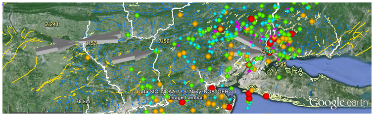
2015 GCH Sykes and ISC 34 Focal Mechanism P-axes NAP-Mid-Atlantic Margin 50km.kmz (169 KB)
2015 NJGWS GCH NE-Central NJ LiDAR Bedrock Interpretation.kmz (322 KB)
2015 NJGWS GCH Bucks County Pa w LiDAR Bedrock Interpretation.kmz (322 KB)
2015 GANJ 32 CM GCH NYC Queens Water Tunnel.kmz (49 KB)
Other GE KMZ Files and WWW Links
Geology Web Tools for coordinate conversion, GE symbol generation, and Dynamic 3-point problem solving, among others.
2015 GCH USGS NJ REGION UTM500K Hydrolines.kmz (311 KB)
2015 NJGWS 100K North NJ Surfical Cover GT 50 ft.kmz (274 KB)
2015-05 GCH NASA-JPL GPS Earth Horizontal-Crustal-Motion Vectors annotated.kmz (169 KB)
Earth Magnetic Anomaly Grid (EMAG2) is specified as a global 2-arc-minute resolution grid of the anomaly of the magnetic intensity at an altitude of 4 km above mean sea level. It was compiled from satellite, marine, aeromagnetic and ground magnetic surveys.
GCH 10-16-2017